Prepared by Tom Mastin PLS
Public Land conveyances
Public Land conveyances are lands that were created the Federal Government Public Land Survey System. The basic concept in these retracements in California is simple; follow the Federal Manual of Surveying Instructions that was in effect at the time of the original survey. The reality is that these retracements can be quite complex. It is not because of the different manuals, there really is not much change in manuals over the years (at least in the basic concept) it is because there are so many variables that might impact the retracement.
In California we have many mexican land grants, which because of the Treaty of Guadalupe Hidalgo in 1848, are senior to public land in California. Those land grants were surveyed before they were honored by the United States. There is all sorts of historical articles about how the original owners were treated by the U.S. government, but that is outside the scope of this site. What concerns us, is how do we retrace those senior rights when we are around them.
Beyond the land grants there are a number of issues in retracing these original surveys, that are far from standard, including the impact of the fraudulent surveys done by the Bensen syndicate. We are going to just look at the more standard solutions to these retracements.
Since 1785 the surveys of Public Lands have been conducted, first starting in Ohio. In 1796 the appointment of a Surveyor General was created who had the responsibility of surveying the public lands. In 1812 the General Land Office (GLO) was formed to manage the public lands, which is why it is common to call the field notes and plats of these surveys as GLO Notes or plats. Currently the responsibility rest with the Bureau of Land Management.
The federal surveyors would survey the public land based on need. These would be areas where individuals had settled and wanted to perfect their ownership. Based on demand they would create an Initial Point, which just as it sounds is where they would start surveying for a specific area. There are about 26 initial points in the continental United States. They would survey out in all directions from this initial point.

These surveys are considered Cadastral Surveys which indicates that they are taking into account the shape of the earth when doing these surveys. From the Initial Point they would establish a Principal Meridian would extend “true” north and south from the initial point. They would then create a base line that would extend east and west on a “true” parallel of latitude. The term True is in quotes because there are a number of definitions of “true” when it comes to direction. For public lands it is based on astronomical direction, which is different than geodetic direction (Direction based on a datum) by what is called the Laplace correction. Laplace is generally small and for most retracements can be ignored because you are using existing or evidence of existing original monuments.
Next guide meridians and standard parallels are established. These are established at 24-mile intervals. The guide meridians go only from the Base Line or standard parallel to the next standard parallel, then are remeasured to 24 miles along the standard parallels before establishing to the north.
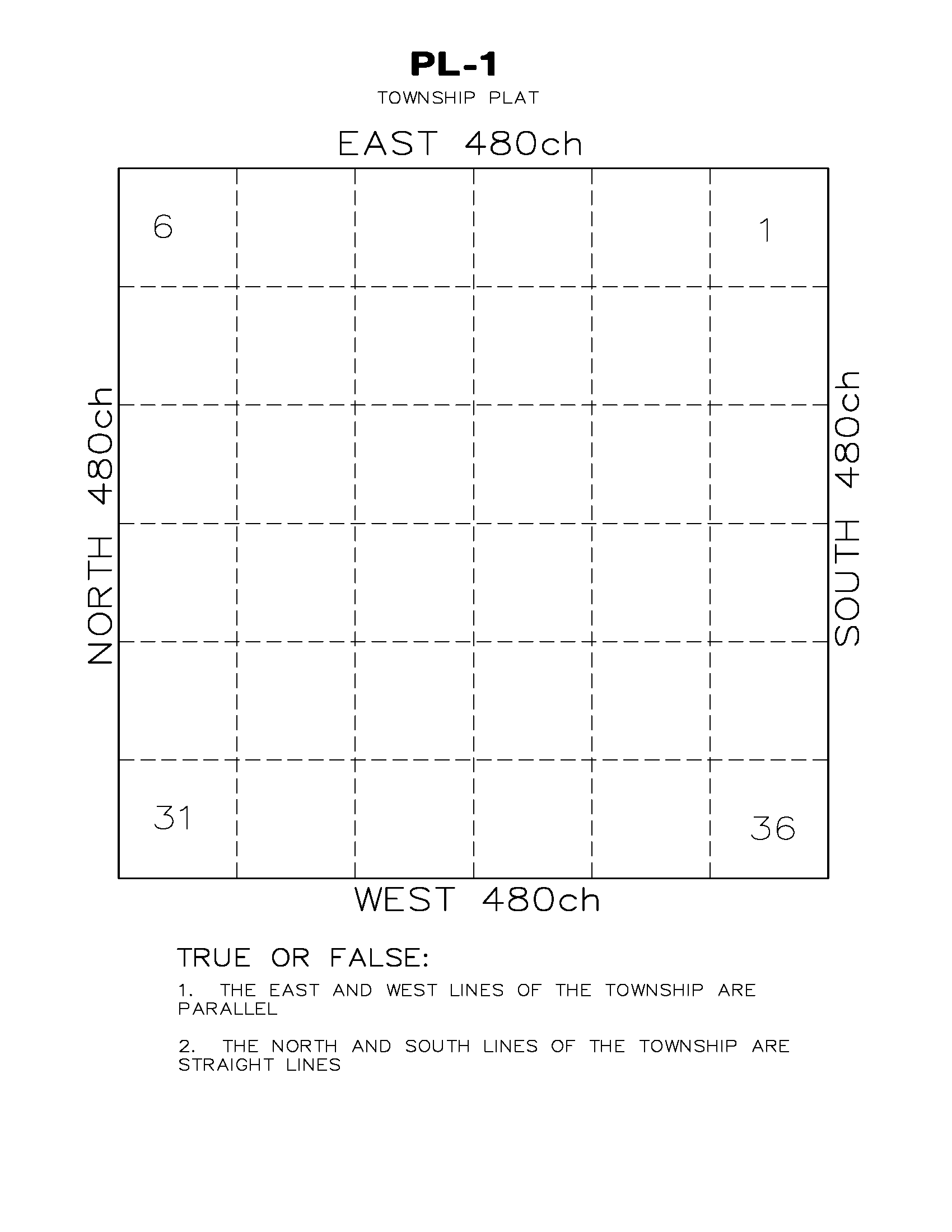
The next step was to create townships exteriors. Townships are 6 miles by 6 miles containing 36 square miles. Townships are defined by how many tiers they are from the initial point. The tiers going north and south are called townships while the tiers going east and west are called ranges.
Finally, the township is subdivided into sections being nominally 1 square mile, with 36 sections in a standard township. The sections are numbered starting at the northeast section as section 1, then snake through the township going west, south, east, south, west and continuing until we end up with section 36 in the southeast corner of the township.
The original surveys would set all quarter corners and all interior section corners. The process on doing this is in theory very systematic and when preparing for an exam assume that the procedure was followed to the letter. In the current Manual of Surveying Instructions (2009) hereinafter called the Manual, Chapter 3 discusses the process of establishing the corners in public lands, and if you are preparting for the LS exam it is a good idea to understand this process. Chapter 4 discusses what they set for monuments and accessories and how they were to mark them.
If you are preparing for the LSIT then a good publication to become familiar with is “Restoration of Lost or Obliterated Corners and Subdivision of Sections. This is a pamphlet that BLM put together going over the basics of public land dependent resurveys. A version can be found HERE
There are three types of Public Land Corners, when performing a retracement:
- Existent Corner: One whose position can be determined by the original monument, it’s accessories, Field Notes, survey records, physical evidence or Testimony
- Obliterated Corner: Although there are no remaining traces of the original corner or accessories, location is perpetuated by some sort of extrinsic evidence that determines the position of the corner beyond a reasonable doubt.
- Lost Corner: The original position cannot be determined and therefore requires a mathematical solution and the use of interdependent corners.
Restoration of Lost Corners
As mentioned above Lost Corners are when the only way to establish a corner is through mathematical means. All effort should be made to determine if the corner is existent or obliterated before considering the corner lost. However, when testing for your competency as a Land Surveyor, more questions will address lost corners, as it is the easiest area to test on.
There are two basic methods for re-establishment of public land “Lost” corners. There is restoration by Single Proportion and by Double Proportion. We will discuss the basic ideas and procedures for these two methods here. There are many variations to the basic, which you will be tested on, and a thorough review and understanding of the Manual of Surveying Instructions (All references in this article to the Manual is to the 2009 Manual of Surveying Instructions) is imperative.
Single Proportion
Single proportionate measurement is generally used on
- Quarter corners within a Township (sec 7-35)
- Township boundary section corners (sec 7-20)
- Expect for the Corners of the Township
- Township boundary quarter corners (Sec 7-20)
- Standard Parallel Corners (Sec 7-18)
Single Proportionate method is used when the monument was established on a single line. It is sometimes called a “two-way” proportion because it is using positions on either side of it to establish it’s position.
The process is to use the nearest identified corners on each side of the monument being established. The lost corner is then reestablished at a proportionate distance between the two identified monuments.
Double Proportion
Double proportionate measurement is generally used on
- Interior section corners (Sec 7-12)
- Township corners (Sec 7-10)
Double Proportionate method is used when the monument is intersected and thereby established by two lines or 4 monuments. The process is more complicated than single proportion. The idea is that corners to the north and south control the latitudinal (north) position and the corners to the east and west control the longitudinal (east) position. In performing this process “cardinal equivalent” (Sec 7-9) distances must be used.
Cardinal equivalent indicates that when looking at a north-south line only the latitude or change in north is considered, not the total distance, and the same for east-west where only the departure is considered. This sometimes is an issue because the line isn’t run a “true” north-south” or “east-west” direction, but it also must be addressed when you are working on a state plane grid instead of geodetic directions.
The basic ideas of determining position using double proportion can be seen in figure 7-1 from the manual.

Figure 7-2 of the Manual shows how the position of a lost corner would be calculated using double proportion.

Again, there are a number of variations of both double and single proportion that should be studied prior to taking your exams.
Closing Corners
Closing corners are not actually a corner but just a line point. Generally, closing corners are corners that are intended to be set on standard parallels, but were not a part of the standard parallel survey. A line is being run that is to intersect the standard parallel and a closing corner is set at where the intersection is determined to be. When a dependent resurvey is done and it is determined the closing corner does not fall on the standard parallel, then the closing corner is only a line point, and the actual intersection is the corner.
Grant Boundaries
In California, especially, there are a number of grant boundaries, mostly for Mexican or Spanish land grants. These grants are senior or superior to the public lands, so those boundaries supersede any public land corners. Those grants were all surveyed as a part of the certification process for the grants and so when running up to one of those lines, the manual has specific instructions on how to adjust those lines. It is primarily a scaling and rotation of the lines and is described in section 7-54 of the manual.

Sample Problems
Let’s work through some sample problems.
 Click on image to see the question.
Answers and explanations to this can be found int the Manual Chapter 2 and 3. Below is the short answer.
Now let’s discuss establishment of corners. Here is a question from a previous LS exam which looks at a number of re-establishments of public land corners.
Try and solve the problem, by referring either to the manual or the pamphlet. When you are done, look below for the answers our experts came up with.
Solutions to PL-3
1a.
Retrace between nearest corners east and west and set (or calculate) temporary position at proper proportionate distance. This will determine the proper departure of the lost corner. Retrace between nearest corners north and south and set (or calculate) temporary position at proper proportionate distance. This will determine the proper latitude of the lost corner. Run due north or south and east or west as relative conditions require. The corner is set at the intersection of the two lines in cardinal directions. All record and measured distances must be first reduced to cardinal equivalents.
1b.
East-west or north-south proportion:
Retrace between nearest identified corners on the line. The lost corner is established on the line between the recovered corners at the proper proportionate distance.
2:
a. Point 2: double proportion between 1 and 8; and 3 and 4
b. Point 5: single proportion between re-established 2 and 8
c. Point 7: intersection between re-established 13 and 6 and re-established 2 and 8.
d. Point 9: single proportion between 8 and 11
e. Point 13: double proportion between 12 and 15; and 6 and 18
f. Point 14: single proportion between reestablished 13 and 15
g. Point 17: intersection between reestablished 14 and 21; and 16 and 18
h. Point 20: single proportion between 19 and 21 to establish temp point. Run north record distance from 18 to establish second temp point. Run east or west from the second point and north or south from the first point as the relative situation determines. The cardinal intersection of the two lines is the corner position.
i. Point 22: record bearing and distance from 19 (one point control)
j. Point 23: run south record distance from 25 to establish temp. Point. Run east from point 24 to establish temp point. Run cardinal directions to intersect to determine corner (two point control).
3: A record of survey must be filed. Per section 8762 ls act.
4: A corner point is determined from the surveying process. A monument is the physical object that marks the corner point.
5.
a. A reset from witness marks (rock, bearing trees, etc) Manual 5-17
b. Reset from topo calls (Manual 5-16)
c. Reset from testimony (Manual 5-9)